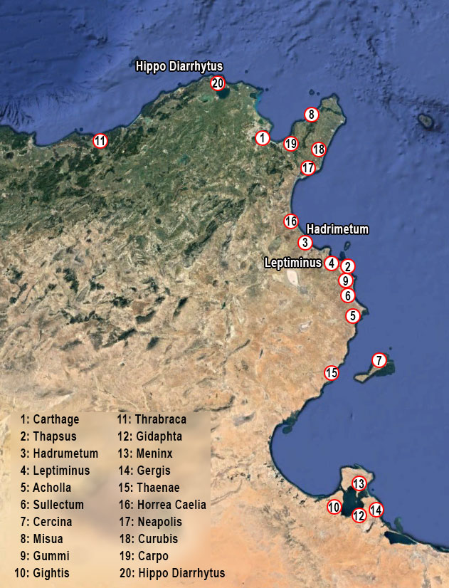
According to the Roman historian Gaius Sallustius Crispus (about 86-37 BC)1, this port city was founded by the Phoenicians at the same time as the nearby port cities of Hadrumetum (present-day Sousse) and Hippo Diarrhytus (present-day Bizerte).
The oldest traces of habitation were found in the two nearby cemeteries and date from the sixth century BC2.
The port is also described in the Periplus of Pseudo-Scylax, an ancient Greek periplus3 from the 4th century BC, which describes the sea route around the Mediterranean and the Black Sea.
The Roman historian Livius (59 BC - 17 AD) mentions that Hannibal Barca called at Leptiminus in 239 BC when he was returning to Africa from Italy and sailed past a burial site: “H“Hannibal saw it as a bad omen and ordered the pilot to sail past the spot and brought the fleet to Leptis, where he disembarked his troops“ 4.
The Greek historian Appian of Alexandria (95 - 165 AD) calls the inhabitants of Leptiminus ‘free citizens’5 and Pliny calls the city an oppidium liberum6 (free fortification on a hill). During the civil wars in the mid-1st century BC, Julius Caesar's garrisons were stationed in Leptiminus and the sea around the city became the scene of a naval battle. 7
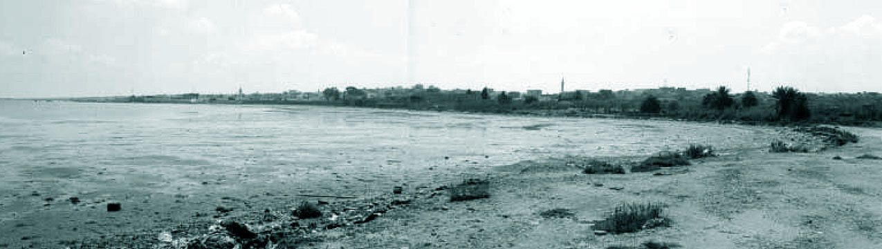
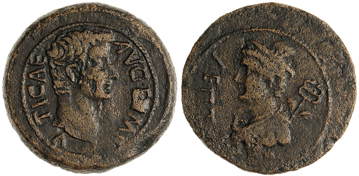
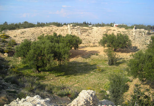
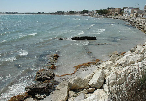
In 47-46 BC, the city became a civitas libera et immunis 8and issued its own coins under Augustus. The city is said to have been given colonial status under Trajan with the title Colonia Ulpia Lepti Minus 9. The ancient city of Leptiminus lies on a small promontory on the bay of Monastir in the Gulf of Hammamet. It is bounded on the west by the mouths of the Wadi el Masourah and the Wadi Bou Hajar and on the east by a small bay, which is itself bounded on the east by a small promontory where the modern town of Lamta is located. The coast is low and sandy and the sea is shallow: the 5m depth line is two kilometres from the shore. Evidence of post-Roman erosion is evident in the cliffs and mosaic floors that have been partially destroyed by the waves. The presence of submerged archaeological structures found during research in 2011 suggests a sea level rise since ancient times of about 50-75 cm10. The modern coastline at Leptiminus would have been up to about 200 m further inland than during the Roman period11. Incidentally, the remains of ancient Leptiminus had been visited, excavated and described by numerous scientists since the 19th century. A preliminary account of these visits and early reports on important monuments at the site was published as early as 199212.
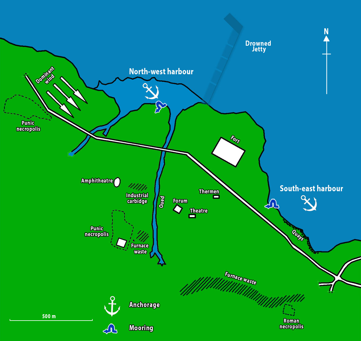
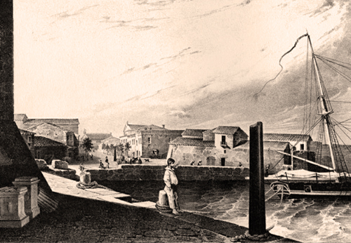
Opportunities for port infrastructure on this unsheltered seashore were limited and boats were probably towed from the water on the Wadi Bou Hajar beach. Although as early as 1893 they reported docks northwest of the village of Lemta. These were recovered and surveyed in later years. No traces of rural habitation from this period were found in the immediate hinterland of the port.
The transformation of the Punic settlement into a Roman city with an area of about 24 hectares seems to have consisted of a new planning of the urban core on the citadel hill along orthogonal lines. Repeated common building lines suggest that there were three phases of expansion from the hill towards the coast and the harbour area, which had a 450-metre-long jetty dating to c. 1st century BC. - 1st century AD, or slightly later13.
The jetty appeared to have had a core of rubble and was lined with blocks of which two courses were still visible in some places. Only at the end, where the jetty changed direction, the water was more than two metres deep. This is a very good example of a pier or jetty built on a shallow shore.
A public bathing complex and the earliest aqueduct also appear to have been built in Leptiminus during this period, probably dating from 93/94 AD.14
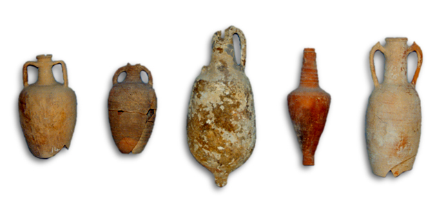
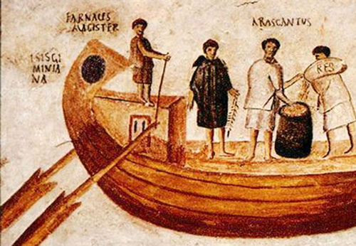
Evidence of in-house production of amphorae has been found in the port, while Pliny mentions that fish products were exported to Rome15. Extensive cremation cemeteries were established southeast and southwest of the city, and rural settlements have been discovered in the immediate hinterland.
The 2nd to 4th century AD marks the height of the city. During this period, the city expanded further eastwards, so that the built-up core of Leptiminus now covered about 45 ha, with a concomitant increase in activity in the suburbium, the suburbs, to a total area of about 150 ha.
Several public buildings date from this period: the amphitheatre from the 2nd or 3rd century AD, along with the dense buildings along the western bank of the Wadi Bou Hajar, and the eastern baths from the Severan period.
Amphorae, African cookware and coarse pottery were produced in large quantities, and iron might also have been produced on a large scale.
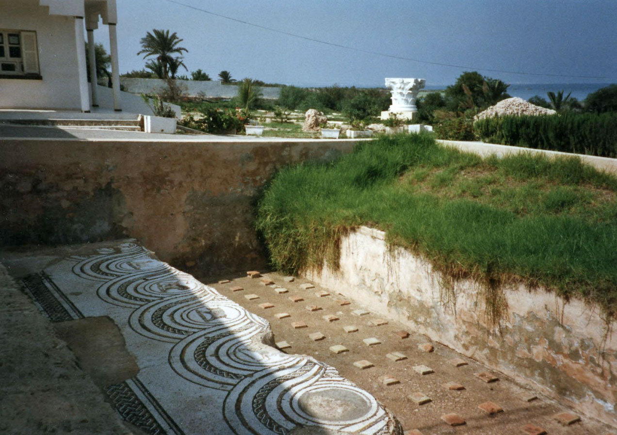
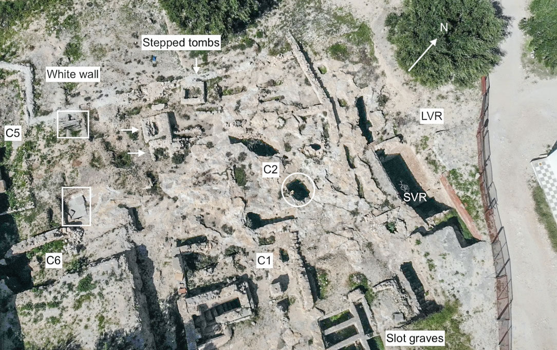
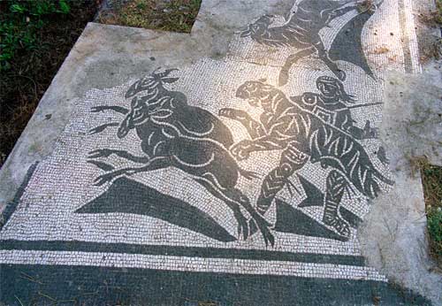
Roman burials occur in all known Punic cemeteries, while a new Roman cemetery was established along the south side of the city centre in the late 2nd-early 3rd century AD (see Figure 3). Several suburban villas and workshops appeared in the suburbs. It is difficult to say whether the city's prosperity continued into the 4th century AD. One of the excavated kilns was abandoned at the end of the 2nd century AD, but other industrial activities can be found elsewhere well into the 4th century AD.
Leptiminus thus became an important port that flourished under Roman rule and exported numerous agricultural products (including olive oil) and garum, a popular fermented fish sauce, large transport amphorae and African Red Slip pottery (a fine tableware that was in high demand throughout the Mediterranean from the 2nd to 7th centuries AD). These goods from Leptiminus were traded throughout the Roman Empire: from Italy, Spain, Portugal and Britain in the west to Egypt, Palestine and Syria in the east.
The excavations
The cemeteries, which span the 2nd to 6th centuries AD and contain about 150 skeletons, are currently being studied and will provide a valuable database for understanding the health, longevity and burial practices of the ancient inhabitants of the settlement.
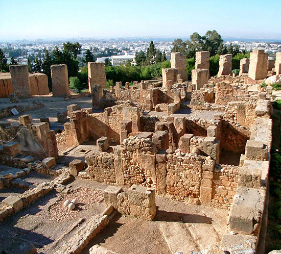
A Roman bathhouse covering an area of about 3,600 square metres is now one of the largest known bathhouses in Roman North Africa. Excavations in 1992 revealed, under the floors of a heated room, courts and tunnels that were used to fire the ovens. In the 6th century AD, the bathing complex was converted into an industrial space where large transport amphorae of clay were produced.
One excavated Roman house gives a good idea of the changing patterns of life in the eastern suburbs of the city. The building was transformed from a house with a beautiful mosaic of Venus in the triclinium (dining room), to an industrial space covered with ash, clay and ceramic waste.
Research shows that Leptiminus was oriented in two ways: towards the sea, towards Mediterranean markets, and towards a hinterland that included many landlocked cities. Other port cities like Leptiminus were scattered along the North African coast in antiquity and probably fulfilled a similar role by participating in a range of urban crafts for consumers that lay in both directions. Although Leptiminus offers archaeologists a rare opportunity to study one of these ports, the city itself was probably not particularly unique. Instead, Leptiminus may be representative of coastal settlements in the region that exported a range of manufactured goods and imported items for both agriculture (iron ores and millstones) and luxury construction (marble).
- Sources
- - Cambridge Expedition to Sabratha 1966: R.A.Yorke
- - Carayon 2008, 3.2.4.4.Leptiminus/Lamta
- - https://lsa.umich.edu/kelsey/research/past-field-projects/leptiminus-archaeological-project-tunisia.html
- - https://portuslimen.eu/site/leptiminus/ by N.Carayon and S. Keay
- - Arthur de Graauw
- - Wikipedia
notes- 1: Sallust - Bellum lugurthinum, 19, 1-2.
- 2: Fantar 1999; Gsell 1920, 135–136; De Smet 1913; Foucher 1967.
- 3: Written navigational aids or sailing instructions.
- 4: Livy, 30, 25, 12
- 5: Appian, Libyca, 94
- 6: Pliny, HN 5.25
- 7: Bellum Africanum, 7, 2 en 29, 2
- 8: Free city with no payment obligations to the state.
- 9: Gascou 1972; Beschaouch 1991; Aounallah, Ben Abdallah and Hurlet 2006
- 10:Stone et al. 2011
- 11: Slim et al. 2004, 154; Stone, Mattingly, and Ben Lazreg 2011, 142.
- 12: Ben Lazreg, Mattingly, and Caciagli 1992, 9–62 (Leptiminus Archaeological Project)
- 13: Stone, Mattingly en Ben Lazreg 2011, 273-274; Davidson 1992
- 14: According to brick stamps of Agathobulus and Cn. Domitius Tullus.
- 15: Plinius NH 31, 94
- 16: Photo Tripadvisor.com
- 17: Photo Romanoimpero.com
- 18: Photo: Leptiminus (Lamta), report no 4. Taken on 18 October 2020 at 12.30pm, published courtesy of Mohammed Amine Sayadi, Hedi Chouchane and Anis Kilani.
- 19: Photo: Home.cc.umanitoba.ca
- 20: Photo: ES.numista.com
 We are committed to providing versions of our articles and interviews in several languages, but our first language is English.